
A vision for moving San Francisco
The overall vision of ConnectSF seeks to answer this central question: What is the future of San Francisco as a place to live, work, and play in the next 25 to 50 years? The vision that emerges was guided by five foundational goals: equity; economic vitality; environmental sustainability; safety and livability; and accountability and engagement.
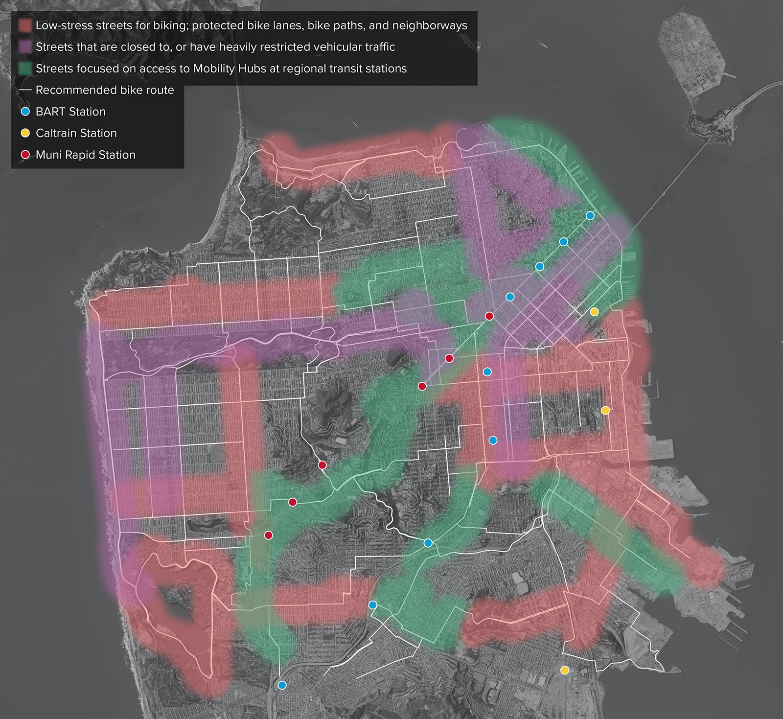
But how do those goals and the broader vision translate into the bicycle network? The Active Transportation Study, a subset of the Streets and Freeways Study, proposes a long-range network of prioritized corridors that moves the City of San Francisco towards that ConnectSF vision.
How do you plan for an active transportation network?
Starting with the goals of ConnectSF, the Active Transportation Study team first thought about “what should a bike network look like in 2050?”. Much has changed in the last two decades in how bike networks are planned and implemented, and the study team assumed a similar level of change into the future. This led to the creation of the Active Transportation Typologies Memo, which provided the building blocks of what a future network should be built from.
Once the building blocks were in place, staff needed to figure out how to apply them across the City. The Data Framework Memo lays out how the study team divided the geography of San Francisco into specific zones, through which potential corridors for the Active Transportation Study would travel. The memo also lays out how the goals of ConnectSF would be represented in specific data and metrics during the study. The details of how zones were created is documented in the Zone Methodology Memo.
Overlaid on these zones were a series of active transportation corridors. The Corridor Suitability Assessment Memo documents the process staff went through to identify these corridors and refine them into a format that could be analyzed for the Active Transportation Study. The Corridor Segment and TAZ Consolidation Memo documents how each corridor was explicitly defined geographically and how corridors were broken up into segments corresponding to the boundaries of the zones.
DOWNLOAD ACTIVE TRANSPORTATION STUDY 1MB
| 1. Active Transportation Typologies Memo | Download |
| 2. Data Framework Memo | Download |
| 3. Zone Methodology Memo | Download |
| 4. Corridor Suitability Assessment Memo | Download |
| 5. Corridor and Segment TAZ Consolidation Memo | Download |
| 6. Data Profiles Memo | Download |
| 7. ATS Zone Profiles | Download |
| 8. ATS Corridor Profiles | Download |
| 9. Network Builds Development Memo | Download |
| 10. Evaluation Framework Methodology Memo | Download |
With both zones and corridors defined, the Data Profiles Memo laid out how metrics relating to ConnectSF goals would be used in an analysis of both. The resulting ATS Zone Profiles and the ATS Corridors Profiles document their performance against each metric.
Using the analysis from the zone and corridor profiles, staff set about developing three conceptual active transportation networks, with the process documented in the Network Builds Development Memo. Once these three networks were developed, staff evaluated them against metrics tied to the ConnectSF goals. The evaluation process, and its results, are documented in the Evaluation Framework Methodology Memo, which helped staff to arrive at the recommended set of priority corridors.